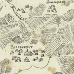
I’m doing a small assignment on mapping part of Melbourne for part of my Information and Interface Design class. I came across these maps on Making Maps, they are so beautiful! The come from HistCARTO – which is in French and consequently not the easiest to navigate for a non French speaker (However much I’d love to). Enjoy!
Published September 17, 2009 by Rebecca Matheson
Published August 26, 2009 by Rebecca Matheson
One of my classes this semester is on Information and Interface design, we are primarily looking at information graphics and I’m loving it. It’s quite a lovely partnership of rational facts, logic, finding relationships between data and visual output. The first project was to create an info-graphic based on our lives, to encompass family, education, interests and to somewhat represent past, present, future (or at least leaves conceptual room for the presentation of the future).
This is mine. Now you can see what crazy things my parents did in dragging us to and from countries. Click for larger image.


